
Tags
assumptions, Cape Cod, dangers of nuclear, elevation, Entergy, flooding, Fukushima, Hurricane Jose, LOOP, Massachusetts, Nuclear Power Station Black Out, nuclear safety, Pilgrim Nuclear Power Station, power outage, rising sea-level, risk analysis, risk management, Sea level, storms, subsidence, Tropical Storm Jose, US NRC
The population within 50 miles (80 km) of Pilgrim Nuclear Power Station was 4,737,792 in 2010. Boston is at risk from any accident at this site.
The major risk to the Massachusetts Pilgrim Nuclear Power Station from Tropical Storm Jose seems to be possible loss of offsite power due to winds (LOOP). One of the strangest things about nuclear power stations is their need for offsite power: “The availability of ac power to commercial nuclear power plants is essential for safe operations and accident recovery. A loss of offsite power (LOOP) event, therefore, is an important contributor to total risk at nuclear power plants.” http://nrcoe.inel.gov/resultsdb/LOSP/
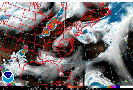
It is apparently this need for offsite power which has given rise to the conspiracy theory that nuclear power stations don’t really produce energy. It is also this fact which creates a major risk of a major accident, if backup power generators fail, as happened at Fukushima. Winds from Tropical Storm Jose could lead to loss of offsite power. The winds are expected to be somewhere in the 15 to 30 mph range with gusts at 50 to 60 mph at the Pilgrim Nuclear Power Station site. These fairly high wind speeds may be of long duration as Jose is expected to remain offshore for an extended period. According to the US NWS: “Tropical Storm Jose will remain nearly stationary to the southeast of Nantucket for the next few days. It will produce a prolonged period of strong winds and severe beach erosion over southeastern New England, especially Cape Cod and Nantucket. The strongest winds will be from Thursday morning through Thursday night.” One of the forecasts states that “Gusty winds will likely down tree limbs and possibly isolated trees, especially since full foliage remains on our trees. Isolated power outages may occur“.
“The loss of all alternating current (AC) power at NPPs involves the loss of offsite power (LOOP) combined with the loss of the onsite emergency power supplies (typically EDGs [Emergency Diesel Generators]). This is also referred to as a station blackout (SBO). Risk analyses performed for NPPs indicate that the loss of all AC power can be a large contributor to the core damage frequency, contributing up to 74 percent of the overall risk at some plants. Although NPPs are designed to cope with a LOOP event through the use of onsite power supplies, LOOP events are considered to be precursors to SBO. An increase in the frequency or duration of LOOP events increases the risk of core damage.” https://www.nrc.gov/reading-rm/doc-collections/gen-comm/reg-issues/2004/ri200405.pdf
“The 2010 U.S. population within 10 miles (16 km) of Pilgrim was 75,835, an increase of 40.5 percent in a decade, according to an analysis of U.S. Census data for msnbc. com. The 2010 U.S. population within 50 miles (80 km) was 4,737,792, an increase of 10.2 percent since 2000. Cities within 50 miles include Boston (35 miles to city center). (Dedman, Bill, April 14, 2011, “Nuclear neighbors: Population rises near US reactors“, msnbc .com, as cited in : https://en.wikipedia.org/wiki/Pilgrim_Nuclear_Generating_Station#Surrounding_population
Update: Problems at Pilgrim from Jose: https://nuclear-news.net/2017/09/23/pilgrim-nuclear-power-station-forced-to-reduce-power-due-to-stormy-weather-and-rising-ocean-temperatures/
Is Pilgrim at Risk of Flooding from Tropical Jose? It remains unclear. Our guess is that the Pilgrim nuclear power station is not considered as located on an “ocean exposed beach” since it sits on Cape Cod Bay though the forecast for the area includes high surf advisory, as seen in the screen shot. However, it doesn’t say if it is the 15 to 20 ft discussed further below. Also, Manomet shore is just to the south of Pilgrim Nuclear Power Station and one of the forecasts says “SHORELINE IMPACTS…EROSION OF SANDY BLUFFS IS EXPECTED SUCH AS ALONG THE MANOMET SHORE. 
“Jose will bring large waves, possibly 15 to 20 feet, to ocean exposed beaches across southeast Massachusetts. Severe beach erosion will occur. Some protective dunes may be at risk of being overtopped or eroded away. Dangerous rip currents will occur at the beaches. With Jose forecast to stall just southeast of the region, the threat of beach erosion and rip currents will be prolonged, likely lasting through the upcoming weekend and perhaps even into early next week. High Surf Advisories are in effect for ocean-exposed beaches outside of the Tropical Storm Warning. * WIND: The strongest winds from this storm event will be from Thursday morning through Thursday night across Cape Cod and the Islands. Gusts to 60 mph are forecast for Nantucket and Martha`s Vineyard with 45 to 55 mph on Cape Cod. Potential impacts in these areas include: – Possible tree limbs broken off with some trees uprooted. – Some roads impassable from large debris, and more within heavily wooded places.”
https://alerts.weather.gov/cap/wwacapget.php?x=RI12586888BA6C.HurricaneLocalStatement.125868959124RI.BOXHLSBOX.959847dcf070ef0cf9164c11629f7113
Last December, Jones River Watershed Association and JRWA’s Cape Cod Bay Watch Program once again raised concerns about flooding and storm impacts on Pilgrim Nuclear Power Station on Cape Cod Bay in Massachusetts, writing to the US NRC: “We continue to believe that the PNPS site, including its nuclear waste storage area, are at risk from flooding and storms…“. They point to discrepancies between the site elevation data used by Entergy and actual elevation when estimating flood risk at the Pilgrim Nuclear Power Station. (The US NRC appears to consistently use the 1929 elevation standard, rather than the 1988 update which takes into consideration subsidence and other changes which have occurred since 1929. Thus, their concerns may apply to most US Nuclear Power Stations.) Furthermore, they point to the use of outdated sea level assumptions, which fail to take into consideration sea level rise! They point out that each tidal epoch is 18 years and that the “previous 1960-1978 epoch was the information used when PNPS was first developed…. The 1983-2001 is the present epoch and shows a rise in sea level. Local present day tide charts are based on this. We are nearly done with the third epoch (2002-2020), when information will be brought to reflect present day conditions.” See their letter here: https://miningawareness.wordpress.com/2017/09/21/pilgrim-nuclear-power-station-at-risk-from-flooding-and-storm-impacts-due-to-outdated-assumptions-location/
Tropical Storm Jose Advisories:
“000 WTUS81 KBOX 202356
TCVBOX
URGENT – IMMEDIATE BROADCAST REQUESTED
Jose Local Watch/Warning Statement/Advisory Number 62
National Weather Service TAUNTON MA AL122017
756 PM EDT Wed Sep 20 2017
MAZ022-210800-
/O.CON.KBOX.TR.W.1012.000000T0000Z-000000T0000Z/
Barnstable MA-
756 PM EDT Wed Sep 20 2017
…TROPICAL STORM WARNING REMAINS IN EFFECT…
* LOCATIONS AFFECTED
– Chatham
– Falmouth
– Provincetown
* WIND
– LATEST LOCAL FORECAST: Below tropical storm force wind
– Peak Wind Forecast: 20-30 mph with gusts to 60 mph
– CURRENT THREAT TO LIFE AND PROPERTY: Moderate
– The wind threat has remained nearly steady from the
previous assessment.
– Emergency plans should include a reasonable threat for
strong tropical storm force wind of 58 to 73 mph.
– To be safe, earnestly prepare for the potential of
significant wind impacts. Remaining efforts to secure
properties should now be brought to completion.
– Dangerous wind is possible. Failure to adequately shelter
may result in injury. Move to safe shelter before the wind
becomes hazardous.
– POTENTIAL IMPACTS: Significant
– Some damage to roofing and siding materials, along with
damage to porches, awnings, carports, and sheds. A few
buildings experiencing window, door, and garage door
failures. Mobile homes damaged, especially if unanchored.
Unsecured lightweight objects become dangerous projectiles.
– Several large trees snapped or uprooted, but with greater
numbers in places where trees are shallow rooted. Several
fences and roadway signs blown over.
– Some roads impassable from large debris, and more within
urban or heavily wooded places. A few bridges, causeways,
and access routes impassable.
– Scattered power and communications outages, but more
prevalent in areas with above ground lines.
* STORM SURGE
– No storm surge inundation forecast
– CURRENT THREAT TO LIFE AND PROPERTY: None
– The storm surge threat has remained nearly steady from the
previous assessment.
– Surf conditions may still be rough with some beach erosion.
Stronger than normal rip currents may also be present.
– Exercise due safety.
– Review your seasonal plan and ensure readiness for the next
storm surge event.
– REALIZED IMPACTS: Being Assessed
– Little to no additional surge impacts expected. Community
officials are now assessing the extent of actual surge
impacts accordingly.
* FLOODING RAIN
– LATEST LOCAL FORECAST:
– Peak Rainfall Amounts: Additional around 1 inch
– CURRENT THREAT TO LIFE AND PROPERTY: Elevated
– The flooding rain threat has remained nearly steady from
the previous assessment.
– Emergency plans should include a reasonable threat for
minor flooding where peak rainfall totals are near amounts
conducive for localized flash flooding and rapid inundation.
– To be safe, prepare for the potential of limited flooding
rain impacts.
– Localized flooding is possible. If flood related watches
and warnings are issued, heed recommended actions.
– POTENTIAL IMPACTS: Limited
– Localized rainfall flooding may prompt a few evacuations.
– Rivers and tributaries may quickly rise with swifter
currents. Small streams, creeks, canals, arroyos, and
ditches may become swollen and overflow in spots.
– Flood waters can enter a few structures, especially in
usually vulnerable spots. A few places where rapid ponding
of water occurs at underpasses, low-lying spots, and poor
drainage areas. Several storm drains and retention ponds
become near-full and begin to overflow. Some brief road and
bridge closures.
* TORNADO
– LATEST LOCAL FORECAST:
– Situation is unfavorable for tornadoes
– CURRENT THREAT TO LIFE AND PROPERTY: None
– The tornado threat has remained nearly steady from the
previous assessment.
– Emergency plans need not include a threat for tornadoes.
Showers and thunderstorms with strong gusty winds may still
occur.
– Little to no preparations needed to guard against tropical
tornadoes.
– Ensure readiness for the next tropical tornado event.
– POTENTIAL IMPACTS: Little to None
– Little to no potential impacts from tornadoes.
* FOR MORE INFORMATION:
– http://weather.gov/box
http://www.nhc.noaa.gov/text/WTUS81-KBOX.shtml
“Wind Advisory
URGENT – WEATHER MESSAGE
National Weather Service Taunton MA
422 PM EDT Wed Sep 20 2017
MAZ006-007-013>021-RIZ002>007-210430-
/O.EXT.KBOX.WI.Y.0020.000000T0000Z-170922T1000Z/
Western Essex MA-Eastern Essex MA-Western Norfolk MA-
Southeast Middlesex MA-Suffolk MA-Eastern Norfolk MA-
Northern Bristol MA-Western Plymouth MA-Eastern Plymouth MA-
Southern Bristol MA-Southern Plymouth MA-Southeast Providence RI-
Western Kent RI-Eastern Kent RI-Bristol RI-Washington RI-
Newport RI-
Including the cities of Lawrence, Gloucester, Foxborough,
Norwood, Cambridge, Boston, Quincy, Taunton, Brockton, Plymouth,
Fall River, New Bedford, Mattapoisett, Providence, Coventry,
West Greenwich, East Greenwich, Warwick, West Warwick, Bristol,
Narragansett, Westerly, and Newport
422 PM EDT Wed Sep 20 2017
…WIND ADVISORY NOW IN EFFECT UNTIL 6 AM EDT FRIDAY…
* Location…Eastern Massachusetts and most of Rhode Island.
* Winds…North 15 to 25 mph with gusts up to 50 mph.
* Timing…Through Thursday night.
* Impacts…Gusty winds will likely down tree limbs and possibly
isolated trees, especially since full foliage remains on our
trees. Isolated power outages may occur.
PRECAUTIONARY/PREPAREDNESS ACTIONS…
Winds this strong are capable of downing tree limbs and branches,
possibly causing isolated power outages. Driving can also be
difficult, especially for high profile vehicles. Use extra
caution. && $$
For the latest updates…please visit our webpage at
http://www.weather.gov/boston
You can follow us on Facebook at
http://www.facebook.com/NWSBoston
You can follow us on Twitter at
@NWSBoston
“Hazardous Weather Outlook
Hazardous Weather Outlook
National Weather Service Taunton MA
439 PM EDT Wed Sep 20 2017
MAZ019-212045-
Eastern Plymouth MA-
439 PM EDT Wed Sep 20 2017
…COASTAL FLOOD ADVISORY IN EFFECT UNTIL 4 AM EDT FRIDAY…
…HIGH SURF ADVISORY IN EFFECT UNTIL 6 PM EDT FRIDAY…
…WIND ADVISORY IN EFFECT UNTIL 6 AM EDT FRIDAY…
This Hazardous Weather Outlook is for southeastern Massachusetts.
.DAY ONE…Tonight.
Please listen to NOAA Weather Radio or go to weather.gov on the
Internet for more information about the following hazards.
High Surf Advisory.
Coastal Flood Advisory.
Wind Advisory.
.DAYS TWO THROUGH SEVEN…Thursday through Tuesday.
Please listen to NOAA Weather Radio or go to weather.gov on the
Internet for more information about the following hazards.
High Surf Advisory.
Coastal Flood Advisory.
Wind Advisory.
.SPOTTER INFORMATION STATEMENT…
Spotter activation is not expected at this time.
$$
High Surf Advisory
COASTAL HAZARD MESSAGE
NATIONAL WEATHER SERVICE TAUNTON MA
420 PM EDT WED SEP 20 2017
MAZ019-210430-
/O.CON.KBOX.CF.Y.0015.000000T0000Z-170922T0800Z/
/O.CON.KBOX.SU.Y.0008.000000T0000Z-170922T2200Z/
EASTERN PLYMOUTH MA-
420 PM EDT WED SEP 20 2017
…COASTAL FLOOD ADVISORY REMAINS IN EFFECT UNTIL 4 AM EDT
FRIDAY…
…HIGH SURF ADVISORY REMAINS IN EFFECT UNTIL 6 PM EDT FRIDAY…
* TIDAL DEPARTURE…1 TO 2 FEET.
* COASTAL FLOOD IMPACTS…MINOR COASTAL FLOODING WITH POCKETS OF
A FOOT OR LESS OF INUNDATION ALONG THE MOST VULNERABLE SHORE
ROADS.
* LOCATION…COASTAL PLYMOUTH COUNTY IN MASSACHUSETTS FROM HULL
TO PLYMOUTH.
* TIMING…MINOR COASTAL FLOODING NEAR THE TIME OF THE EARLY
AFTERNOON AND LATE NIGHT HIGH TIDES THROUGH EARLY FRIDAY
MORNING. HIGH SURF AND DANGEROUS RIP CURRENTS WILL PERSIST
THROUGH FRIDAY.
* SURF AND RIP CURRENT RISK…WAVES GENERATED BY THE WINDS ABOUT
JOSE WILL RESULT IN HIGH SURF ALONG THE HULL TO PLYMOUTH
COASTLINE. THIS WILL ALSO LEAD TO DANGEROUS RIP CURRENTS.
* SHORELINE IMPACTS…EROSION OF SANDY BLUFFS IS EXPECTED SUCH
AS ALONG THE MANOMET SHORE.
PRECAUTIONARY/PREPAREDNESS ACTIONS…
A RIP CURRENT…SOMETIMES MISTAKENLY CALLED AN UNDERTOW…IS A
STRONG BUT NARROW CURRENT OF WATER FLOWING FROM THE BEACH TO THE
SURF ZONE. IT CAN RAPIDLY CARRY A SWIMMER INTO DEEPER WATER…AND
EXHAUST AN INDIVIDUAL TRYING TO SWIM AGAINST IT.
IF YOU ARE CAUGHT IN A RIP CURRENT…SWIM PARALLEL TO THE BEACH
UNTIL OUT OF ITS PULL…THEN SWIM BACK TO SHORE. ANOTHER MEANS OF
ESCAPE FOR GOOD SWIMMERS IS TO RIDE THE CURRENT OUT UNTIL IT
DISSIPATES…THEN SWIM BACK TO SHORE OUTSIDE OF THE RIP CURRENT.
DO NOT ATTEMPT TO SWIM DIRECTLY INTO THE RIP CURRENT…IT CAN
EXHAUST AND DROWN EVEN THE STRONGEST SWIMMER.
IN ADDITION…VIEWERS OF LARGE SURF SHOULD STAY IN SAFE AREAS
WELL AWAY FROM POSSIBLE SPLASHOVER. INDIVIDUAL WAVES MAY BE MORE
THAN TWICE THE AVERAGE WAVE HEIGHT…WHICH CAN SWEEP A PERSON
INTO THE WATER FROM WHAT MAY SEEM TO BE A SAFE VIEWING AREA.
FALLING INTO TURBULENT AND SOMETIMES ROCKY WATERS CAN RESULT IN
INJURY THAT REDUCES THE CHANCE OF SURVIVAL.
A COASTAL FLOOD ADVISORY IS ISSUED FOR MINOR COASTAL FLOODING OF
THE MOST VULNERABLE SHORE ROADS AND/OR BASEMENTS DUE TO THE
HEIGHT OF STORM TIDE OR WAVE SPLASHOVER. THE MAJORITY OF ROADS
REMAIN PASSABLE WITH ONLY ISOLATED CLOSURES. THERE IS NO
SIGNIFICANT THREAT TO LIFE…AND IMPACT ON PROPERTY IS MINIMAL.
&&
&&
TIME OF HIGH TOTAL TIDES ARE APPROXIMATE TO THE NEAREST HOUR.
SCITUATE
MLLW CATEGORIES – MINOR 11.5 FT, MODERATE 14.0 FT, MAJOR 16.0 FT
MHHW CATEGORIES – MINOR 1.8 FT, MODERATE 4.3 FT, MAJOR 6.3 FT
TOTAL TOTAL DEPARTURE
DAY/TIME TIDE TIDE FROM NORM WAVES FLOOD
FT MLLW FT MHHW FT FT IMPACT
——– ——— ——— ——— ——- ——–
21/12 AM 11.5/12.0 1.8/ 2.2 1.3/ 1.8 8-9 MINOR
21/01 PM 11.7/12.2 2.0/ 2.5 1.7/ 2.2 11-12 MINOR
22/01 AM 11.5/12.0 1.8/ 2.2 1.6/ 2.0 13-14 MINOR
22/02 PM 11.4/11.9 1.7/ 2.2 1.5/ 2.0 7-8 MINOR
23/02 AM 10.9/11.4 1.2/ 1.7 1.3/ 1.8 5-6 NONE
“This product covers Southern New England **Strongest winds are expected Thursday and Thursday night along the southeast Massachusetts coast** NEW INFORMATION ————— * CHANGES TO WATCHES AND WARNINGS: – None * CURRENT WATCHES AND WARNINGS: – A Tropical Storm Warning is in effect for Barnstable MA, Block Island RI, Dukes MA, and Nantucket MA * STORM INFORMATION: – About 150 miles south-southeast of Nantucket MA – 39.2N 69.1W – Storm Intensity 70 mph – Movement Northeast or 45 degrees at 8 mph SITUATION OVERVIEW —————— Tropical Storm Jose will remain nearly stationary to the southeast of Nantucket for the next few days. It will produce a prolonged period of strong winds and severe beach erosion over southeastern New England, especially Cape Cod and Nantucket. The strongest winds will be from Thursday morning through Thursday night. Minor to moderate coastal flooding is possible, especially on Nantucket late tonight through Thursday night. Minor coastal flooding is still possible on Friday. Bands of locally heavy rain will continue to impact Cape Cod and the Islands into Thursday evening. Storm total rainfall of up to 4 inches is likely on Nantucket, where some flooding still is possible. Gusts to 60 mph are forecast for Nantucket and Martha`s Vineyard Thursday and Thursday night, with 45 to 55 mph on Cape Cod, tapering to 30 to 40 mph in the Boston to Providence corridor. Life-threatening conditions will continue on the coastal waters southeast of New England through Thursday night, with seas of 20 to 25 feet and tropical storm force wind gusts. POTENTIAL IMPACTS —————– * SURGE: Protect against locally hazardous surge having possible limited impacts across Cape Cod and Nantucket. At Nantucket Harbor, the biggest concerns are the Thursday late morning and Thursday late night high tides. Potential impacts in these areas include: – Localized inundation with storm surge flooding mainly along immediate shorelines and in low-lying spots, or in areas farther inland near where higher surge waters move ashore. – Sections of near-shore roads and parking lots become overspread with surge water. Driving conditions dangerous in places where surge water covers the road. – Severe beach erosion. Heavy surf also breaching dunes, mainly in usually vulnerable locations. Strong rip currents. – Minor to locally moderate damage to marinas, docks, boardwalks, and piers. A few small craft broken away from moorings. * OTHER COASTAL HAZARDS: Jose will bring large waves, possibly 15 to 20 feet, to ocean exposed beaches across southeast Massachusetts. Severe beach erosion will occur. Some protective dunes may be at risk of being overtopped or eroded away. Dangerous rip currents will occur at the beaches. With Jose forecast to stall just southeast of the region, the threat of beach erosion and rip currents will be prolonged, likely lasting through the upcoming weekend and perhaps even into early next week. High Surf Advisories are in effect for ocean-exposed beaches outside of the Tropical Storm Warning. * WIND: The strongest winds from this storm event will be from Thursday morning through Thursday night across Cape Cod and the Islands. Gusts to 60 mph are forecast for Nantucket and Martha`s Vineyard with 45 to 55 mph on Cape Cod. Potential impacts in these areas include: – Possible tree limbs broken off with some trees uprooted. – Some roads impassable from large debris, and more within heavily wooded places. – Scattered power and communications outages. * FLOODING RAIN: Protect against locally hazardous rainfall flooding having possible limited impacts across Nantucket. A Flash Watch remains in effect for Nantucket. Potential impacts include: – Flood waters can enter a few structures, especially in usually vulnerable spots. A few places where rapid ponding of water occurs at underpasses, low-lying spots, and poor drainage areas. Some brief road closures. – Although unlikely, localized rainfall flooding could prompt a few evacuations. PRECAUTIONARY/PREPAREDNESS ACTIONS ———————————- * EVACUATIONS: Evacuations are unlikely with this event. However, you should be prepared to follow any local instructions from emergency management officials. * OTHER PREPAREDNESS INFORMATION: Continue to closely monitor NOAA Weather Radio or other local news outlets for official storm information. Listen for possible changes to the forecast. * ADDITIONAL SOURCES OF INFORMATION: – For information on appropriate preparations see ready.gov – For information on creating an emergency plan see getagameplan.org – For additional disaster preparedness information see redcross.org NEXT UPDATE ———– The next local statement will be issued by the National Weather Service in Taunton MA around 12 AM EDT, or sooner if conditions warrant. (Emphasis our own throughout.)

You must be logged in to post a comment.