
Tags
Colorado River, dam failure, dam tsunami, flooding, Gulf of Mexico, Hurricane Harvey, hurricane safety, NASA, Rain, satellite images, South Texas Nuclear, South Texas Nuclear Project, US NRC
From NASA: “On August 31, 2017, the Moderate Resolution Imaging Spectroradiometer (MODIS) on NASA’s Terra satellite captured this image of the Texas coast and the Houston metropolitan area. Note the brown rivers and bays, full of flood water from Hurricane Harvey. Along the coast, muddy, sediment-laden waters from inland pour into a Gulf of Mexico that also was churned up by the relentless storm.”
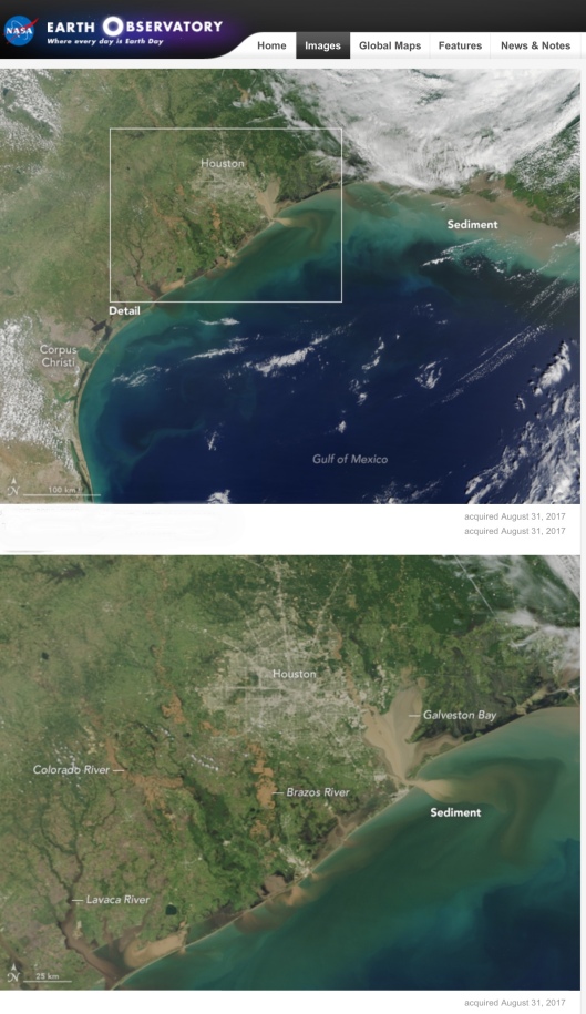
“NASA Earth Observatory image by Jesse Allen, using data from the Land Atmosphere Near real-time Capability for EOS (LANCE). Caption by Michael Carlowicz.
Link to original story on Earth Observatory and link to original images: https://earthobservatory.nasa.gov/NaturalHazards/view.php?id=90866
Instrument(s): Terra – MODIS ”
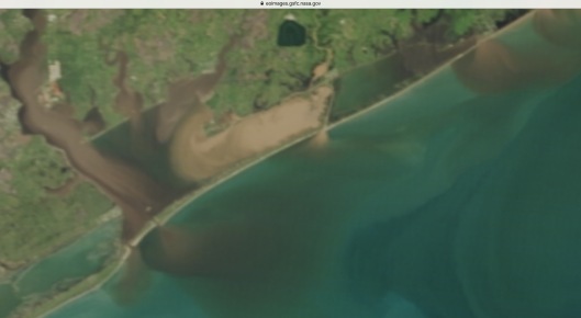
NASA Earth Observatory image by Jesse Allen, using data from the Land Atmosphere Near real-time Capability for EOS (LANCE) Zoom in of higher resolution image showing the huge dam at the South Texas Nuclear Power Station site apparently still intact as of August 31st, though the nearby waterways continue to rise.
Below is the regular Google map image with Harvey location super-imposed.

The Colorado River passes near the South Texas Nuclear site.


You must be logged in to post a comment.